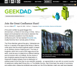
The cool-but-intimidating blog, GeekDad had an intriguing post this morning. Eric Zimmermann, a geography enthusiast living in China, posted about his hobby of documenting "Confluence Points" - the exact point where a whole degree of Latitude and Longitude meet.
He points out that a lot of the time, it isn't easy to get to these confluence points; they aren't necessarily near major roads (or even land, for that matter. For the purposes of demonstration, I just looked up Zero Degrees Latitude/Zero Degrees Longitude and found that lies it well off the coast of West Africa.) This makes getting to these points something of an adventure.
This got me thinking...
Where is the nearest confluence point in relation to my school?
I looked up the town of Deerfield, New Hampshire on GoogleMaps, but discovered to my surprise that it was placed in the White Mountains, several hours' drive from its actual location.
Hmmmm...
Well, that happens sometimes.
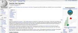
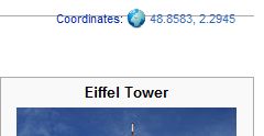
So I fell back on my next-most-favorite mapping tool - Wikipedia. I looked up Deerfield, then looked for the link at the right of the page, labeled "Coordinates".
I looked up the town of Deerfield, New Hampshire on GoogleMaps, but discovered to my surprise that it was placed in the White Mountains, several hours' drive from its actual location.
Hmmmm...
Well, that happens sometimes.
So I fell back on my next-most-favorite mapping tool - Wikipedia. I looked up Deerfield, then looked for the link at the right of the page, labeled "Coordinates".
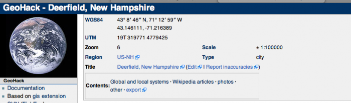
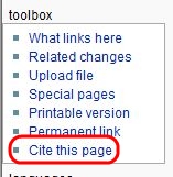
Clicking this took me to a page called "GeoHack", which told me way, WAY more about Deerfield's latitude and longitude than I had ever wanted to know.
Among other useful tools, there were links to take me directly to those coordinates in MapQuest, GoogleEarth and about a dozen other mapping websites. I didn't use any of these links this time, but nodded with satisfaction at how, once again, Wikipedia is much cooler than anyone gives it credit for.
I highlighted and copied the coordinates for Deerfield, then plugged them back into GoogleMaps. I removed all the fractions of degrees from the coordinates, which left me with 40 Degrees North Latitude, 71 Degrees West Longitude.
I hit Return...
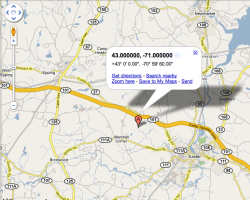
...and got this.
It turns out that our nearest confluence point is just up the road a little bit - though apparently in somebody's back yard. It wouldn't really be all that hard to zip up there and take a picture of it.
It turns out that our nearest confluence point is just up the road a little bit - though apparently in somebody's back yard. It wouldn't really be all that hard to zip up there and take a picture of it.
[Admittedly, you could calculate this just as easily with a good map and a ruler, but I was very lazy this morning and didn't want to get off my couch.]
All this leads me to think about what kind of classroom projects I could design out of this.
Here's what I've come up with so far:
1. This is a good way to introduce or reinforce the concepts of Latitude and Longitude. A highly motivated classroom teacher could have his or her students map calculate and map all the confluence points in New Hampshire. (For teachers in bigger states, they could calculate the points around their county.) [Curriculum connections to Math]
2. If the class was studying Map Reading or Orienteering, this could make for a really good field trip - finding and photographing the closest confluence points. [Curriculum connections to Physical Education]
3. The class could design a webpage or blog with an interactive map, showing all the confluence points and providing links to photos the students had taken of them. [Curriculum connections to Literacy and Technology standards]
4. A very motivated class could do some research and find other elementary or middle schools near other, more out-of-reach confluence points and email teachers or students there to take pictures of them and email them back. [Curriculum connections to more Literacy and Technology standards]
The only real question remaining is - am I that motivated?
Time will tell.

 RSS Feed