For the second year in a row, I had my 8th graders research 19th Century primary sources and shop for historical Americans from the 1897 Sears-Roebuck Catalog. As usual, the most successful part of this project was my two-day lead-up to it, where I delved into topics like drug use and Victorian underwear. The project itself was a mixed success. The students were exposed to primary sources and definitely enjoyed the project, but clearly, some students put more effort into it than others. Some students, for instance, were confused about which person they were actually shopping for, which could have been clarified by looking at their photographs. Other students however, put a lot of thought into their gifts and used the information they had about their people to buy surprising and delightful gifts that their people would have loved. Overall, I'm not unhappy about how this project turned out this year.
I'll keep you posted on how it all turns out.
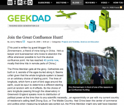 The cool-but-intimidating blog, GeekDad had an intriguing post this morning. Eric Zimmermann, a geography enthusiast living in China, posted about his hobby of documenting "Confluence Points" - the exact point where a whole degree of Latitude and Longitude meet.He points out that a lot of the time, it isn't easy to get to these confluence points; they aren't necessarily near major roads (or even land, for that matter. For the purposes of demonstration, I just looked up Zero Degrees Latitude/Zero Degrees Longitude and found that lies it well off the coast of West Africa.) This makes getting to these points something of an adventure.This got me thinking...
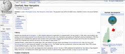 Where is the nearest confluence point in relation to my school?I looked up the town of Deerfield, New Hampshire on GoogleMaps, but discovered to my surprise that it was placed in the White Mountains, several hours' drive from its actual location.Hmmmm...Well, that happens sometimes.So I fell back on my next-most-favorite mapping tool - Wikipedia. I looked up Deerfield, then looked for the link at the right of the page, labeled "Coordinates".
 Clicking this took me to a page called "GeoHack", which told me way, WAY more about Deerfield's latitude and longitude than I had ever wanted to know. Among other useful tools, there were links to take me directly to those coordinates in MapQuest, GoogleEarth and about a dozen other mapping websites. I didn't use any of these links this time, but nodded with satisfaction at how, once again, Wikipedia is much cooler than anyone gives it credit for.I highlighted and copied the coordinates for Deerfield, then plugged them back into GoogleMaps. I removed all the fractions of degrees from the coordinates, which left me with 40 Degrees North Latitude, 71 Degrees West Longitude.I hit Return...
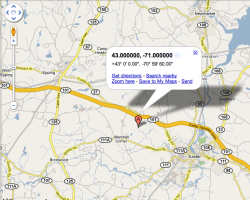 ...and got this.
It turns out that our nearest confluence point is just up the road a little bit - though apparently in somebody's back yard. It wouldn't really be all that hard to zip up there and take a picture of it.
[Admittedly, you could calculate this just as easily with a good map and a ruler, but I was very lazy this morning and didn't want to get off my couch.]
All this leads me to think about what kind of classroom projects I could design out of this.
Here's what I've come up with so far:
1. This is a good way to introduce or reinforce the concepts of Latitude and Longitude. A highly motivated classroom teacher could have his or her students map calculate and map all the confluence points in New Hampshire. (For teachers in bigger states, they could calculate the points around their county.) [Curriculum connections to Math]
2. If the class was studying Map Reading or Orienteering, this could make for a really good field trip - finding and photographing the closest confluence points. [Curriculum connections to Physical Education]
3. The class could design a webpage or blog with an interactive map, showing all the confluence points and providing links to photos the students had taken of them. [Curriculum connections to Literacy and Technology standards]
4. A very motivated class could do some research and find other elementary or middle schools near other, more out-of-reach confluence points and email teachers or students there to take pictures of them and email them back. [Curriculum connections to more Literacy and Technology standards]
The only real question remaining is - am I that motivated?
Time will tell.
 A couple of years ago, somebody directed me to one of the oddest documents I'd seen in a long time - a list of predictions from the turn of the last century about what life in America would be like in the year 2000.This sort of thing always makes my brain hurt. If you've ever read any "alternative history" science fiction, like some of the stuff by Robert Heinlein or Harry Turtledove, you know what I mean. We generally walk around with a pretty good idea of how history has played out and without really thinking about it too much, we adopt a sort of historical chauvinism - "Well, of COURSE it worked out like that! What sort of stupid world do you think we live in that wouldn't turn out like that?" Then you read something that points out that our world could have turned out very, VERY different, with just a few twists and turns, and it really messes with your head.
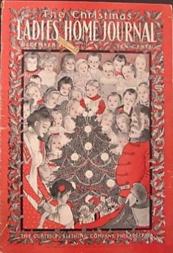 Do you remember those old newsreels classroom movies we watched as kids that showed the Kitchen of the Future, or Life on the Moon, where housewives would cook dinner with a push of a button, then lounge around on Swedish-looking furniture, while their husbands zipped off to work with their jet-packs and briefcases?What the Lady's Home Journal did in December of 1900 was something like that, but about thirty or forty years before anyone else thought to do it. They asked leading experts and scientists to give their best guesses as to what the situation would be like in their fields of study in a hundred years' time.The predictions were pretty amazing, both because of what they got right and what they got spectacularly wrong. - Color Photography? - Check
- Intantanious beaming of information from around the world? - Check
- Peas the size of softballs? - Not So Much
- Giant Navies of zeppelins armed with doomsday devices? - 50/50
It's the wrong predictions that are the most interesting to me - both because I get lost in thought imagining a world where those things are true, but also because it gives some real insight into what an educated world-view was in 1900. Someone once said that if you want to know what society was really like at a given time, read its etiquette books. If they are telling you not to do something, it probably means that a lot of people were actually doing that.This is sort of like that. What they thought would happen was an extension of what they saw happening around them at the time.
What I did About all This:
I'm a big believer in passionate teaching. My feeling is that if I bring a huge amount of interest and excitement to any subject, I can sweep my students along on the wave of my enthusiam. So, as days went by and I continued to obsess about this 100+ year-old list of predictions, I started wondering what I could do with it in the classroom.
Here's what I came up with:
 | predictions_of_the_year_2000.doc | | File Size: | 107 kb | | File Type: | doc |
Download File
I designed a project around the predictions.
I broke down the 29 big, multi-part predictions into 77 smaller, individual predictions. I rewrote the language to make it a little easier for 21st Century 8th Graders to understand. I printed them up on slips of paper and put them in the Awesome Jar of Destiny. (Da, da, DAAAAAHHH!!!)
After setting up the concept and reading some of the predictions to my students, I had each of them draw a prediction from the AJofD. Each of them was responsible for making a poster telling what their prediction was and whether it had come true or not. If it had, they were supposed to give evidence of how it had happened. If (and more interestingly), it had not, they were supposed to show that it hadn't and to tell what we can learn about how people in 1900 saw the world that made them make that kind of guess.
This was their first big project of the year.
Did it Work? Was it all Rainbows and Unicorns?
Well, not all rainbows and unicorns - maybe cheap glitter and rented ponies.It turns out that this "alternate history" concept is pretty hard for 13 year-olds to wrap their heads around. I used a short homework assignment to help them with the idea of making predictions and wondering about the future, but some of my students were solidly concrete-operational at that point in the year and still had a hard time understanding what I was looking for. I'd probably have a little more luck assigning this project at the end of the year, when they've gone through their Amazing 8th Grade Cognitive Development Growth Spurt, but the end of the year is pretty packed already.On the other hand, one of my goals is to challenge my advanced and gifted students more and this really grabbed some of their interests.I think we'll do this project again this fall, with a little more scaffolding and maybe as a podcast; students could interview each other about their predictions and findings. Or maybe as a VoiceThread...Hmmmm...
 After a lot of angst and near-heartbreak, the final projects for the Car Unit are done! (Well, as done as they are going to be; as always, there are a few students who did not complete the project, but overall this one is in the bag.)
Ultimately, in spite of a lot of mid-project frustration, the final product was pretty satisfying. Many of the students put some real work into these interviews and we got some great stories.
 A brief overview:
This was the final project for a new interdisciplinary unit my team tried out with this year's 8th grade. The topic of the unit was "Cars" and the theme was "Responsibility". In each of the four core curriculum areas, we used automobiles as a platform to address certain core ideas. In my class (Social Studies), we looked at the history of horse manure in America and how cars were seen as a giant leap forward in social responsibility early in the 20th Century. We looked at Henry Ford and how he changed the face of American Labor and we looked at some of the social changes brought about by car culture.
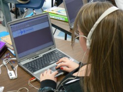
For their final project in Social Studies, students were told to interview someone over the age of 35 about a lesson that they had learned in Responsibility from cars or driving. Students were given bonus points for each year over the age of 65 their interviewees were. [The goal was to encourage them to go out into the community and learn something from the older residents. Most interviewed their parents, though.]
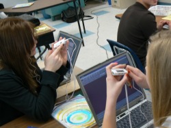
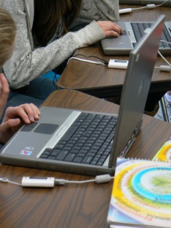
When they had recorded their interviews the students edited them to around two minutes in length and made a one-slide PowerPoint presentation identifying who the interviewee was, what the essential lesson of Responsibility they took away from the interview was and including a relavent picture (with sources cited).
I took the individual slides and sound files and combined them into longer PowerPoint presentations that we watched in class. We went over each project according to the rubric the class had been given at the beginning of the project and the students participated in my grading of the project.
 Once I had four complete PowerPoint presentations (one for each class), I tried to publish them online, so parents and a larger audience could view them. I did this in two ways:
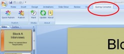
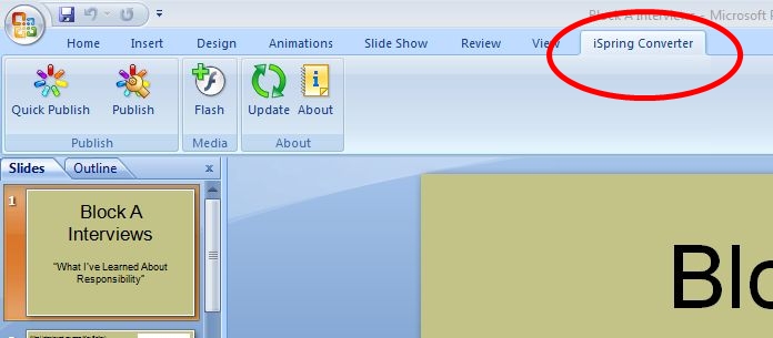
I downloaded a freeware application called iSpring Converter that adds a tab to your PowerPoint menu bar that allows you to more-or-less instantly convert a PowerPoint slideshow into a flash animation movie that you can post on your website. This turned out to be really easy. It will allow us to post the projects directly on the DCS website and the quality of each movie is really good.
 The next step was a little trickier.
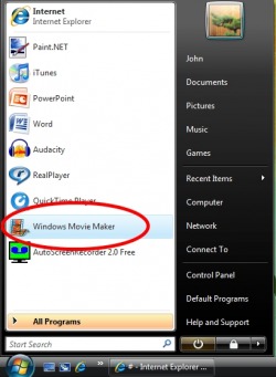
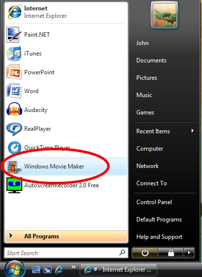
I used another freeware program called AutoScreenRecorder to record each PowerPoint as it ran in real time, then used Windows Movie Maker to edit it and add the students' soundfiles to it. (I'll go into this in greater detail in a later post.)
This is not a big deal - I learned how to do all this last year on another student project. The bigger problem surfaced when I tried to post these movies online.
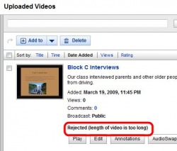 In the past, I've published videos of student work to TeacherTube, basically a school-safe version of YouTube. Unfortunately, this time around, there was some sort of glitch in the system. I uploaded one of the videos at school and the website said to hold on, this might take a few minutes, etc..., and after an hour or so, SOMETHING got uploaded to my TeacherTube account, but it wouldn't play and I kept getting odd error messages. I assumed this was a problem of our school's filter or of TeacherTube itself, so after trying again at home, I decided to upload the student movies to YouTube. I figured that it would carry a little more prestige with the students anyway.
My videos uploaded pretty well, but somehow were never ready to play. Finally, this morning, I looked at my YouTube account more closely and realized that - duh - the videos were way too long for YouTube, which does, after all, specialize in short video clips of beer commercials and waterskiing squirrels. (I say this with all the affection in the world. You know at this point the special place YouTube holds in my heart.)
Finally, I ended up uploading the videos to Vimeo, a different online video service, which seems to suit our needs for this particular project better.
Anyway, without any further ado, here are the 2009 student Car Projects:
Overall, I would classify this project as a qualified success. I will definitely try it again with next year's class.
Click here to view the New Hampshire State Department of Education Social Studies Frameworks standards adressed by the Car Unit.
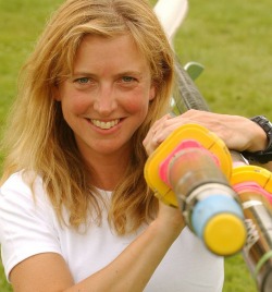
 All summer, I have been listening to a really remarkable podcast - Roz Rows the Pacific.
A woman named Roz Savage, who rowed solo across the Atlantic Ocean a couple of years ago is currently rowing across the Pacific Ocean. If she succeeds, she'll be the first woman to do this. Her trip will be in three legs - San Francisco to Hawaii, Hawaii to Tuvalu and Tuvalu to Australia. Because she will obviously need to rest up between the legs of this trip, it will take a couple of years.
As I write this, she is a little less than a thousand miles from Hawaii - almost done with the first leg of the trip.
Because modern technology like satelite phones, gps units and the internet have all come down so much in price over the past few years, it is very easy to keep up with her progress. She has:
· A podcast that is updated three times a week, where Roz tells what happened to her at sea over the past few days. This is strangely compelling, especially considering that NOTHING much happens on a day-to-day basis: just rowing, rowing and maybe some more rowing (on most days, she doesn't even see birds). The more you listen to this, though, the more you end up thinking about her very tiny environment.
For instance, a few weeks into her trip, her watermaker broke down totally and completely; it will have to be replaced when she gets to Hawaii. It's not a trip-ending disaster; most of her ballast is made up of bags of fresh water, so she can drink her ballast throughout her trip, replacing it with sea water as she goes. This just means that she has to carefully consider each and every drop of water she uses. (Given that she rows twelve to fifteen hours a day, that is a very tricky balance to strike.)
· A blog - She updates a blog about once a day. (Again, fascinating in a zen kind of way - looking at the tiny details of her life at sea.)
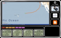
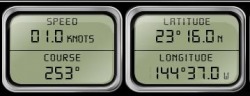 · A marine tracking website that updates her position, speed and course every day
 So, how does this relate to the classroom?
Hard to tell. If everything goes well, Roz will finish up the first leg of her trip sometime in early September - a little too early to make a viable class project out of this. She should start the second leg of the voyage next winter, which would give a teacher plenty of time to plan a good project around this.
Here are a few possible activities I see:
· Giving her latitude and longitude coordinates to students each morning and having them track her progress on a big classroom map. At the end of a particular period of time, this could be compared to the map generated by MarineTrack, the website that provides the coordinates.
· Mocking up a floorplan of her boat and planning out packing lists (sort of like the "What would you take with you in a covered wagon?" activity that many of us have used over the years.)
· Writing letters or emails as a class. One of the main reasons Roz is making this trip is to raise awareness of ocean conservation. There are some great writing assignments in there somewhere.
· Converting nautical miles to statute miles, knots to miles per hour, metric to imperial measurements, etc...
· Studying currents, prevailing winds, tides, storms and other weather systems.
· Learning just where the heck Tuvalu is and studying the history and geography of the islands of the South Pacific.
These strike me as really good projects for 4th-7th grades. (I suspect our 8th graders could never get past the idea of her going a couple of months without washing her hair or shaving her legs.)
|


 RSS Feed